
Accurate and comprehensive data is the cornerstone of any successful infrastructure project, particularly when it involves large-scale water resource management and irrigation. Yet, in many regions marked by conflict, instability, or limited institutional capacity, reliable data is often scarce or fragmented. This scarcity poses a critical challenge: how can planners and engineers design sustainable projects when the information needed to assess feasibility is incomplete or inconsistent?
The answer lies in innovative approaches that combine field ingenuity, advanced modeling, and strategic stakeholder collaboration. Large-scale irrigation projects in fragile environments provide a compelling case study for how data scarcity can be navigated without compromising the rigor or quality of feasibility assessments.
One such example is Afghanistan’s Qosh Tepa Canal Irrigation Project—a megaproject aiming to transform agricultural productivity in the country’s northern provinces by diverting water from the Amu Darya River to irrigate up to 500,000 hectares of land. Despite limited historical data, difficult terrain, and security challenges, the project’s feasibility studies exemplified how multi-layered data collection and analytical techniques can overcome these hurdles to provide a sound foundation for decision-making.
The Challenge of Limited Data in Fragile Contexts
In regions like northern Afghanistan, decades of conflict and underinvestment have severely limited the availability of reliable hydrological, environmental, and soil data. Key datasets such as continuous river flow records, soil quality analyses, and topographic measurements were either incomplete or non-existent. This lack of information complicates essential assessments, including water availability, irrigation potential, environmental impacts, and socio-economic considerations.
Moreover, security and logistical challenges restrict field access, while institutional coordination among government agencies can be complex, especially for transboundary water resources like the Amu Darya River, which serves multiple Central Asian countries.
These factors require feasibility studies to go beyond conventional data reliance, demanding innovative and adaptable methodologies to build a reliable evidence base.
Integrating Fieldwork, Remote Sensing, and Advanced Modeling
Overcoming data scarcity demands a comprehensive and flexible approach:
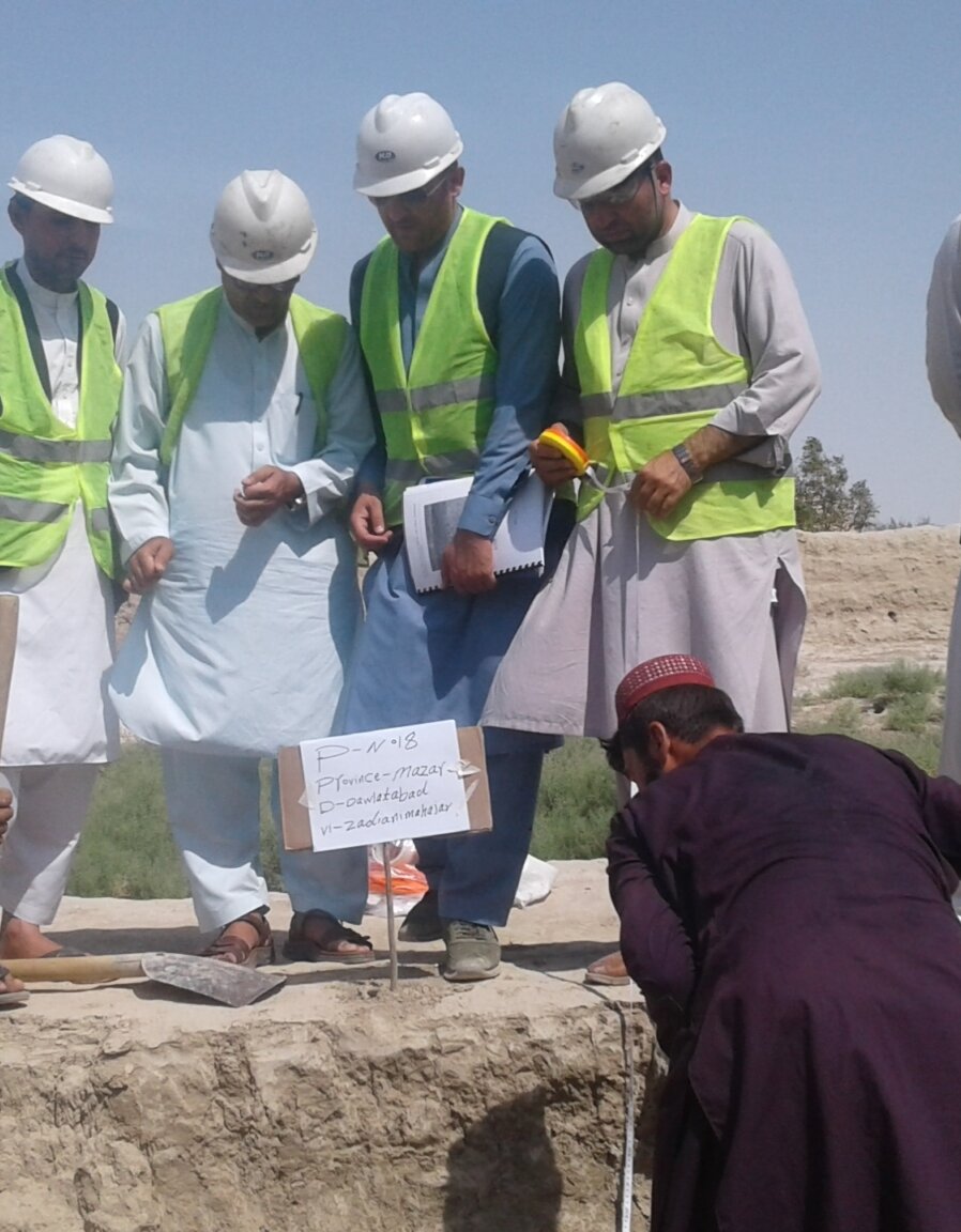
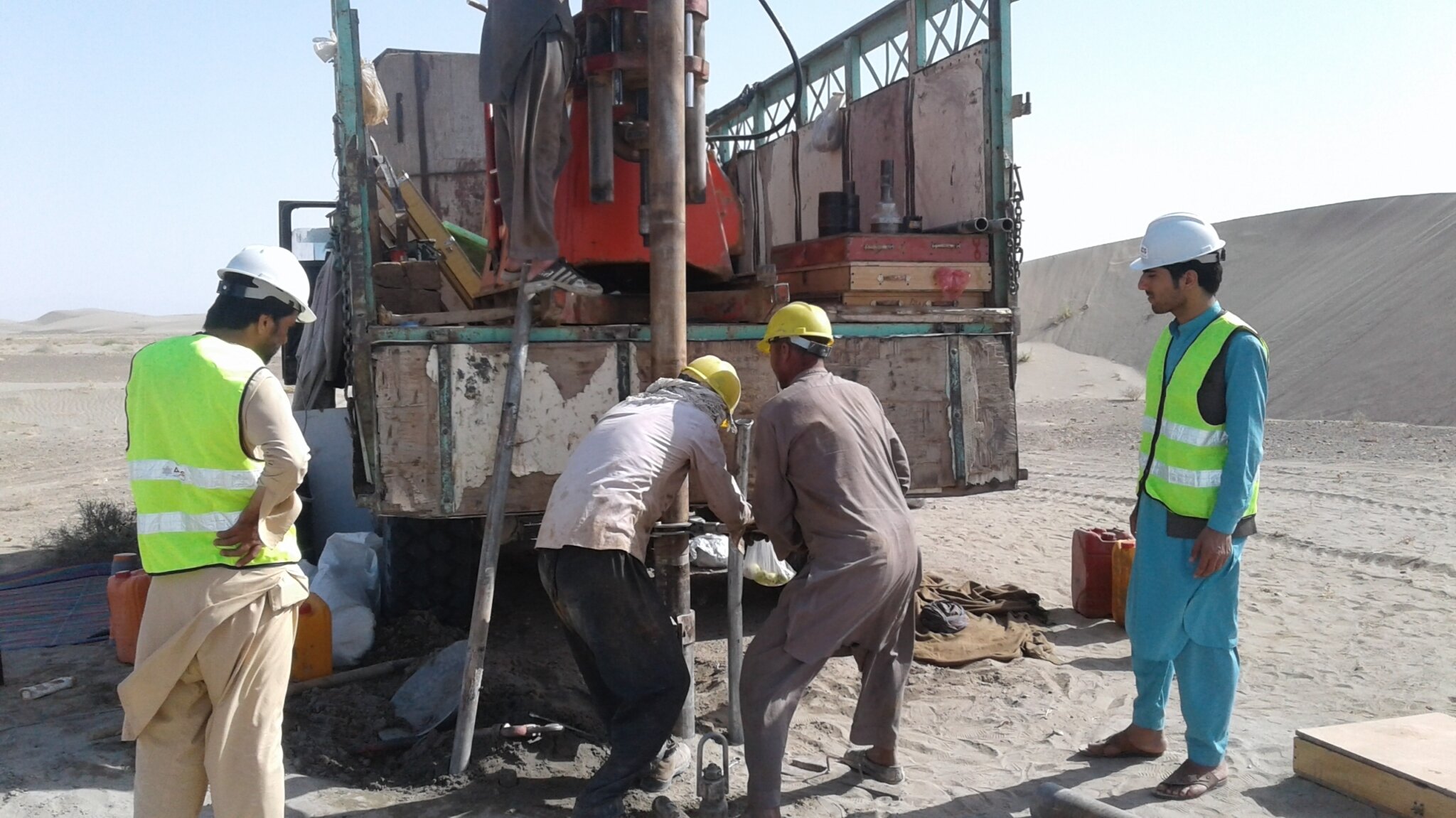
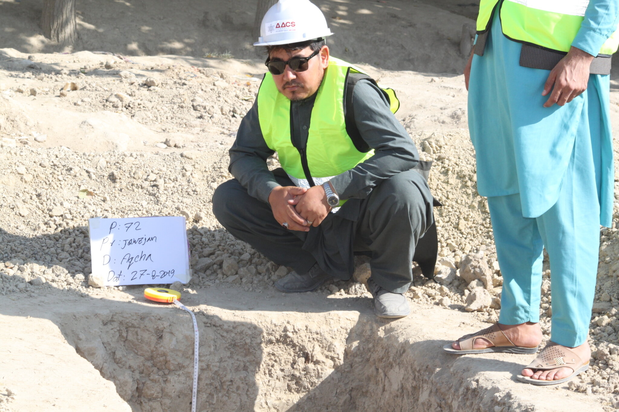
Extensive Ground Surveys: Despite difficult conditions, robust field investigations are critical. In the Qosh Tepa project, drilling over 100 wells along the proposed canal route provided vital groundwater data. Soil profiles and samples were collected extensively to evaluate fertility, salinity, and suitability for irrigation. Precision topographic surveys, supported by geodetic control points, ensured accurate mapping for engineering design.
Hydrological Modeling: With incomplete streamflow records, hydrological models such as the Hydrologic Engineering Center’s Hydrologic Modeling System (HEC-HMS) simulate precipitation-runoff dynamics, providing estimates of river flows essential for water resource planning. These models help fill historical data gaps and support scenario analysis under variable climatic conditions.
Climate Change Considerations: Incorporating climate projections into feasibility assessments adds resilience to long-term planning. By using global climate models and emission scenarios, planners can assess future water availability and adapt irrigation designs accordingly.
Environmental and Social Assessments: Field surveys combined with community consultations assess potential ecological impacts and social consequences. Integrating these qualitative data points helps ensure that project designs minimize adverse effects and gain local acceptance.
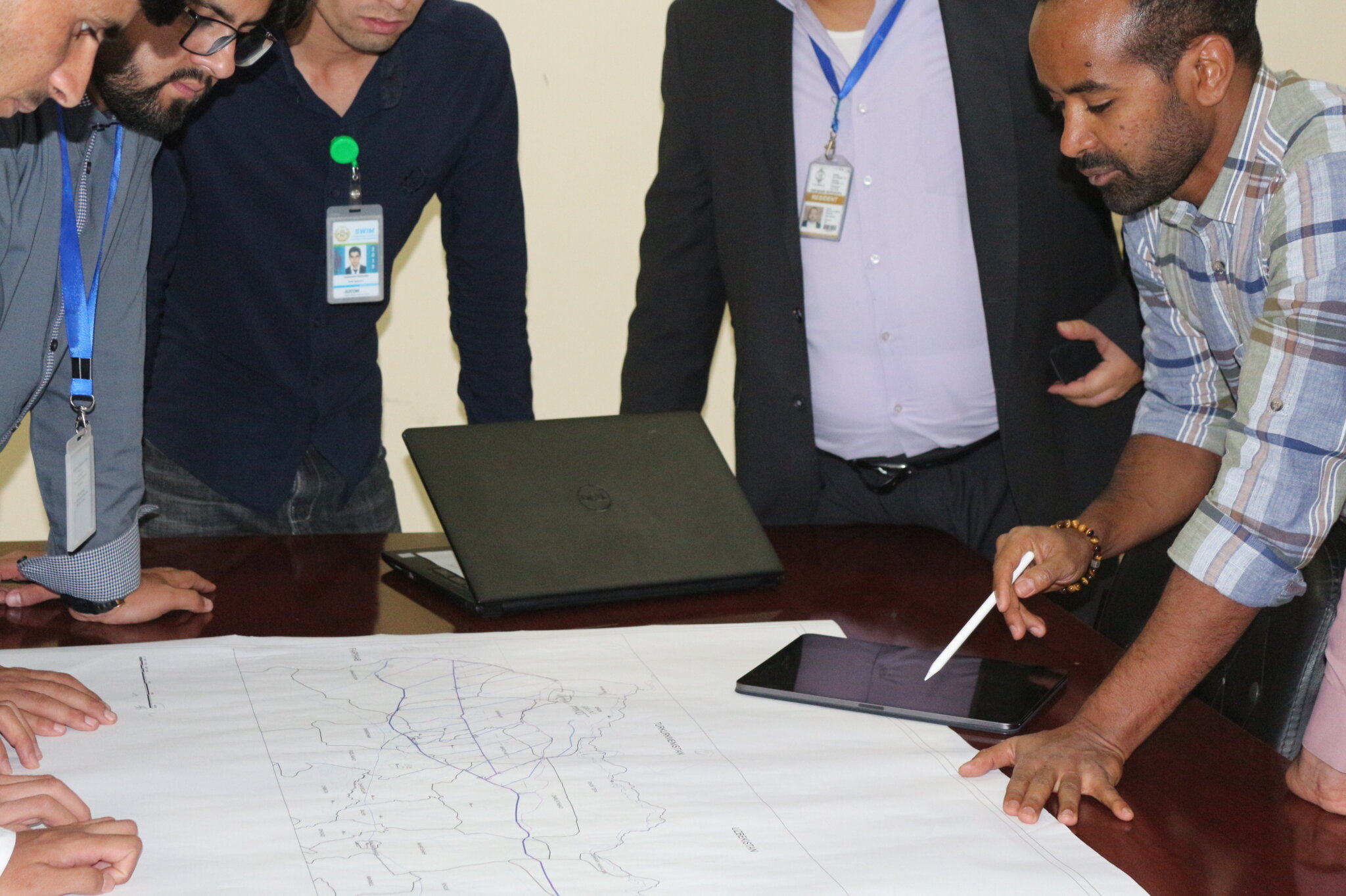
Coordinating Across Stakeholders and Data Sources
Complex infrastructure projects in data-scarce environments require strong collaboration among multiple stakeholders. Effective data-sharing agreements and transparent communication protocols help bridge institutional gaps and improve data reliability. This is particularly important when projects involve transboundary resources, as in the case of the Amu Darya River, where upstream developments can affect downstream countries.
Regular coordination between ministries responsible for agriculture, energy, environment, and water resources ensures that diverse perspectives and requirements are accounted for early in the feasibility process. Maintaining detailed documentation and clear data governance protocols helps mitigate misunderstandings and align priorities.
Delivering Robust, Actionable Insights Despite Constraints
Even under conditions of limited baseline data and compressed project timelines, rigorous and methodical feasibility studies can deliver dependable and actionable insights to inform critical decision-making. The cornerstone of such success lies in the strategic integration of targeted field investigations, adaptive analytical models, and continuous stakeholder engagement. By carefully balancing technical precision with pragmatic constraints, feasibility assessments can overcome data gaps to outline viable options, assess risks, and forecast long-term outcomes with reasonable confidence.
In practice, this approach involves systematically evaluating potential infrastructure sites, comparing alternative engineering methods, and simulating water allocation scenarios under varying environmental and socio-economic conditions. A case in point is the detailed technical assessments that were conducted to identify the optimal canal intake location for the Qosh Tepa Canal Irrigation Project. This site’s elevation allowed for gravity-fed irrigation — significantly reducing long-term operational costs and maximizing irrigable land.
Advanced water allocation modeling further ensured that irrigation expansion would balance agricultural needs with environmental flow requirements and the interests of downstream countries, addressing key geopolitical sensitivities.
Lessons for Future Feasibility Studies in Data-Poor Environments
Several critical lessons emerge from projects operating under data scarcity:
- Prioritize Early Field Data Collection: Intensive field surveys to gather hydrological, soil, and topographic data are indispensable, even in challenging environments.
- Employ Advanced Analytical Tools: Hydrological and climate models can fill critical data gaps, but require calibration and validation with field data.
- Establish Clear Stakeholder Frameworks: Coordinated data sharing and transparent communication reduce institutional barriers and improve study reliability.
- Maintain Methodological Flexibility: Study designs must adapt to evolving data availability while balancing technical rigor and practical constraints.
- Define Data Cutoff Dates: To avoid indefinite delays, set clear deadlines for data inclusion and finalize analyses based on the best available evidence.
Conclusion
Data scarcity should not be an impediment to conducting high-quality feasibility studies for complex infrastructure projects. Through integrated approaches combining thorough fieldwork, innovative modeling, and stakeholder collaboration, it is possible to build robust evidence bases that inform sustainable, resilient, and socially responsible development.
The experience of large-scale irrigation projects in fragile contexts demonstrates that challenges in data availability can be overcome with expertise and innovation. Such projects provide valuable templates for future feasibility assessments, helping to ensure that infrastructure investments yield long-term benefits even in the most difficult environments.